Guide
See your Google Maps Timeline on a map
Google Maps shows your Timeline one day at a time. That is fine for finding where you were last Tuesday, and no help at all for seeing a year of driving, a three-month road trip, or every visit to one client. The trips are all in your Timeline; they just need to come out of the phone and onto one map.
Export your Timeline
Since 2024 Timeline lives on the phone, so the export comes from the phone:
Android
- Open Settings on your phone.
- Go to Location → Location services → Timeline.
- Tap Export Timeline data. This produces a
Timeline.jsonfile.
iPhone
- Open the Google Maps app.
- Tap your profile picture → Settings → Location & Privacy.
- Find the Timeline export option and choose Save to Files.
An older Google Takeout archive works too, and can be dropped in alongside a phone export to cover more years.
Every trip of the year on one map
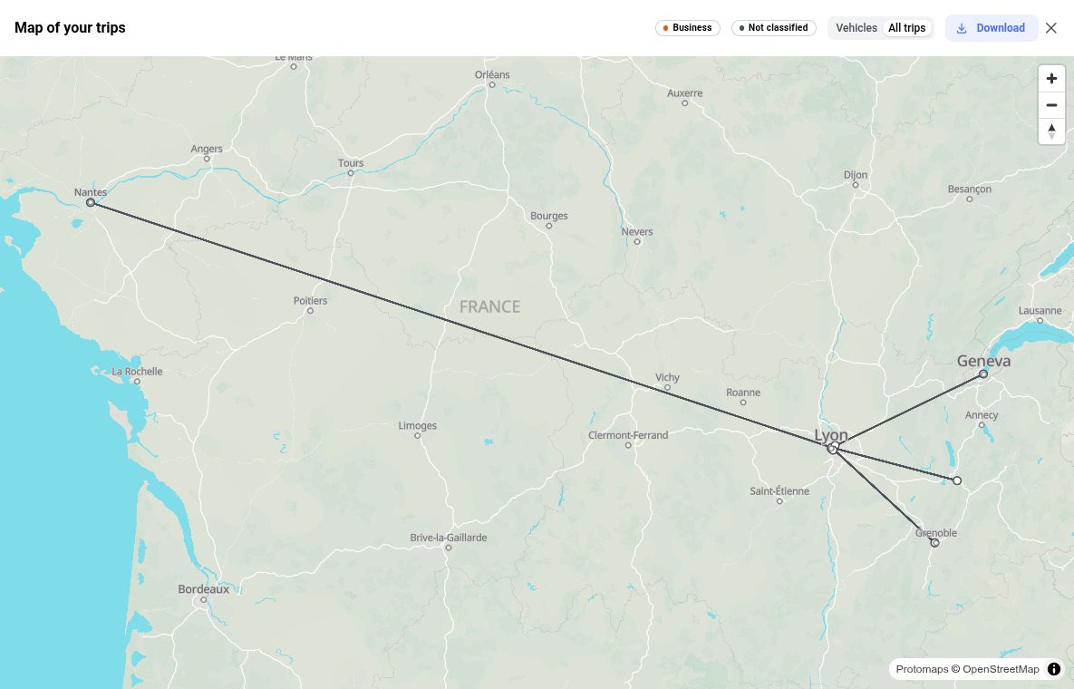
Open the export in Time-mile. The file is read in your browser and your trips are drawn there; the background map comes from our own server, not from a mapping company. Choose Map of your trips under the trips table, or Map next to Export:
- Drives first. The map opens on vehicle trips, since a year of walks would bury them. Switch to All trips to see everything.
- Coloured by purpose. Once you have marked trips as business, home-to-work or personal, each draws in its own colour, so a business trip that ended somewhere unexpected stands out.
- Click to read. A line gives the trip's date, distance and purpose; a place gives how many days you went there.
Check a single trip
Tick the trip's row in the table and press Map (1): only that trip is drawn. Tick several to compare them, for example every visit to the same site.
Straight lines: an export only carries the road between two stops when the phone recorded it. iPhone exports usually hold a start and an end, so those trips are drawn as a lighter straight line. The places, dates and distances are unaffected.
Print a road trip
Zoom the map to the trip, then use Download: an image, or a landscape A4 page with the dates of the trips as a title. The map is redrawn at three times the screen resolution for printing, with the OpenStreetMap attribution included. For a larger poster, the image is the one to send to a print shop.
Prefer to build the map yourself? The Export menu writes the same trips as KML, which Google My Maps and Google Earth import, or GPX for other mapping apps: one line per trip, one pin per place with the days you went there.
Map your year
Drop your Timeline export to see your trips in a table for free. The map, its downloads and the full exports come with a paid plan for that year.
Launch Time-mileFrequently asked questions
Can I see all my Google Timeline trips on one map?
Not in Google Maps itself, which shows Timeline one day at a time. Export the Timeline from your phone and open the file in a tool that reads it: Time-mile draws every trip of the year on one map, and lets you tick a single trip to see it alone.
Why are some trips drawn as straight lines?
An export only holds the road between two stops when your phone recorded it. iPhone exports usually give a start and an end, so the trip is drawn as a straight line between them, lighter than a trip whose route was recorded. The start, the end and the distance are still right.
Can I print my road trip as a wall map?
Yes. Frame the trip on the map, then download it as an image or as a landscape A4 page. The image is drawn at three times the screen resolution so it holds up in print, with the OpenStreetMap attribution the map data requires.
Can I open my Timeline in Google My Maps or Google Earth instead?
Yes. Time-mile exports your trips as KML, which Google My Maps and Google Earth import, or as GPX for other mapping apps. Each trip becomes a line and each place a pin listing the days you went there.